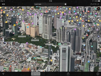
AppleMapの東京都内が一部3D化されました
Jun
23
 新宿付近。ランドマーク他目印のマークが表示されるので検索し易い。
 富士山も3D化されています。
 Macで見ればより迫力ありそうです。
 iPhoneで表示

 3D化されたナビゲーションをシミュレート
 朝の連続小説の「花子とアン」の主人公、村岡はなの出身校 東洋英和女学院を表示。
 多摩川が立体地図の南の境界。
 東京デズニーランドが東の立体化限界
 羽田空港
羽田空港
 お台場付近。
 表示を航空写真のみに切り替えるとランドマークが等は表示されなくなります。


 イエス・ノー(呑んべぇ)
Posted at 2014-06-23 21:47
People Who Wowed This Post
Posted at 2014-06-24 02:44
People Who Wowed This Post
Posted at 2014-06-23 23:32
People Who Wowed This Post
Posted at 2014-06-24 02:47
People Who Wowed This Post
If you are a bloguru member, please login.
Login
If you are not a bloguru member, you may request a free account here:
Request Account